Tour de Mont Blanc
- Date: 13.8.2022 – 17.8.2022 (4,5 days)
Plán cesty
- den Les Houches (FRA) – Refuge du col de la Croix du Bonhomme (FRA) – 30 km, 2385 m nahoru, 965 m dolů
- den Refuge du col de la Croix du Bonhomme (FRA) – kemp Grande Jorasses (ITA) – 41 km, 2034 nahoru, 2871 dolů
- den kemp Grande Jorasses – Champex Lax campground (SUI) 41 km, 2116 m nahoru, 2232 m dolů
- den kemp Champex Lax (SUI) – Tre-le Champ le Bas (FRA) – 26 km, 2067 m nahoru, 2153 m dolů
- den Tre-le Champ le Bas (FRA) – Les Houches (FRA) 27 km, 1931 m nahoru, 2316 m dolů
Plan of the journey
- day Les Houches (FRA) – Refuge du col de la Croix du Bonhomme (FRA) – 30 km, 2385 m up, 965 m down
- day Refuge du col de la Croix du Bonhomme (FRA) – Camping Grande Jorasses (ITA) – 41 km, 2034 up, 2871 down
- day Grande Jorasses campground – Champex Lax campground (SUI) 41 km, 2116 m up, 2232 m down
- day Champex Lax campground (SUI) – Tre-le Champ le Bas (FRA) – 26 km, 2067 m up, 2153 m down
- day Tre-le Champ le Bas (FRA) – Les Houches (FRA) 27 km, 1931 m up, 2316 m down
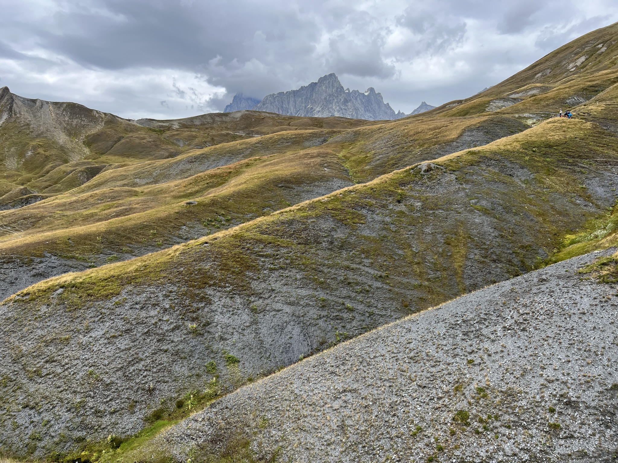
Znáte trasu Tour de Mont Blanc? Je to jedna z nejkrásnějších tras v Evropě a vede kolem dokola nejvyšší hory Evropy Mont Blancu. Navíc je zajímavá tím, že prochází třemi státy – Francií, Švýcarskem a Itálií. Z každého úseku nabízí krásný výhled na tuto ikonickou horu, kterou tak poznáte ze všech stran. Trasa měří 165 km a nastoupáte a sestoupáte na ní 10 633 výškových metrů. Všude na trase je voda, možnost se dobře najíst i se ubytovat. Doporučuji však stan sebou. Jsou zde jedny z nejkrásnějších míst na stanování, kdy vstáváte s výhledem jak z pohádky. Pokud rádi chodíte po horách, přidejte si tuto trasu na svůj “bucket” list.
Do you know the Tour de Mont Blanc hiking trail? It’s one of the most beautiful trails in Europe and goes around the Europe’s highest mountain – Mont Blanc. What’s more, it’s interesting because it passes through three countries – France, Switzerland and Italy. Each part of the trail offers beautiful views of this iconic mountain, so you can see it from all sides. The route is 165 km long and you will ascent and descent 10,633 m. There is water, good food and also accomodation everywhere along the trail. I recommend, however, that you take your tent with you. There are some of the most beautiful places to camp, where you wake up with a view like in a fairy tale. If you like to hike in the mountains, add this trail to your bucket list.
V bodech:
- Trasa má 165 km a přes 10 tis metrů převýšení. Většinou se plánuje na 5 – 10 dní.
- Zaparkovat můžete zdarma na parkovišti vyhrazeném přímo pro ty, kteří jdou Tour de Mont Blanc (TMB) v Les Houches.
- Začínejte brzy ráno. Na trase budete sami a počasí je jistější.
- Nejkrásnější jsou výhledy v průsmycích.
- Pokud si chcete zakoupit oficiální magnet či nálepky trasy TMB pro daný rok, udělejte to na trase v restauracích/ubytováních. Jinde tyto suvenýry neseženete.
- Stanování – ve Francii můžete postavit stan kdekoliv, v Itálii a ve Švýcarsku však ne. Campy jsou většinou za rozumnou cenu a můžete v nich zakoupit i jídlo. Spousta lidí však stanuje i mimo tyto kempy – přijde na místo později večer a odchází hned brzy ráno.
- Pitná voda je na hlavní trase k dispozici z různých studánek téměř pořád. Ze začátku jsem nosila u sebe 2 litry vody, poté, maximálně 1,5 litru, protože se voda dala doplnit opravdu téměř všude.
- Jídlo jsme řešili tak, že jsme měli své snídaně a svačiny a lehčí oběd a večeři jsme si kupovali v místních restauracích/chatách. Jdete 3 zeměmi, které jsou vyhlášené svým jídlem a přišlo nám škoda toho nevyužít. Jídlo bylo opravdu dobré. Na oběd mají na výběr i lehčí jídla od polévek přes omelety a večer se servíruje menu s více chody – je potřeba doplnit energii 🙂
- Platit kartou můžete všude na trase.
- Hlavní trasa má velmi příjemný terén a jde tak zvládnout rychle.
- Z hlavní trasy můžete udělat pár odboček – my například zvolili ve Švýcarsku trasu z Champex Lax kolem ledovce Trient – výhledy byly nádherné, ale terén byl mnohem těžší – suť a opravdu velmi ostrá stoupání. Tuto trasu doporučuji, ale pouze za dobrého počasí, rozhodně ne za mokra. Na tomto úseku také není možno doplnit vodu a je dobré s tím předem počítat. Úsek vám bude trvat mnohem déle, než kilometry napovídají a je velmi náročný, ale pokud máte možnost, jděte do něj!
In points:
- The trail has 165 km and over 10 thousand metres of elevation gain. It is usually planned for 5 – 10 days.
- You can park for free in the car park reserved for those going on the Tour de Mont Blanc (TMB) in Les Houches.
- Start early in the morning. You will be alone on the trail and the weather is more stable.
- The most beautiful views are in the passes.
- If you want to buy the official TMB trail magnet or stickers, do it at the challets along the route. You can’t get these souvenirs elsewhere.
- Camping – you can camp anywhere in France, but not in Italy and Switzerland. Campsites are usually reasonably priced and you can buy food in them. However, lots of people camp outside these campsites – arriving later in the evening and leaving early in the morning.
- Drinking water is available from various wells on the main route. At the beginning I carried 2 liters of water, then, at most, 1.5 liters, because water could be refilled really almost everywhere.
- We carried our own breakfasts and snacks and were buying lighter lunches and dinners. You pass through 3 countries that are renowned for their food and we thought it would be a shame not to take advantage of that. The food was really good. For lunch they have a choice of lighter meals from soups to omelettes and in the evening they serve a multi course menu – you need to replenish your energy 🙂
- You can pay by card everywhere on the trail.
- The main trail has very pleasant terrain so the route goes quickly.
- You can make a few detours from the main route – for example, we chose the route from Champex Lax around the Trient glacier in Switzerland – the views were spectacular, but the terrain was much harder – rubble and very steep. I recommend this route, but only in good weather, definitely not in wet conditions. It is also not possible to refill water on this part of the trail. The route will take you much longer than the kilometres suggest and is very challenging, but if you have the chance, go for it!

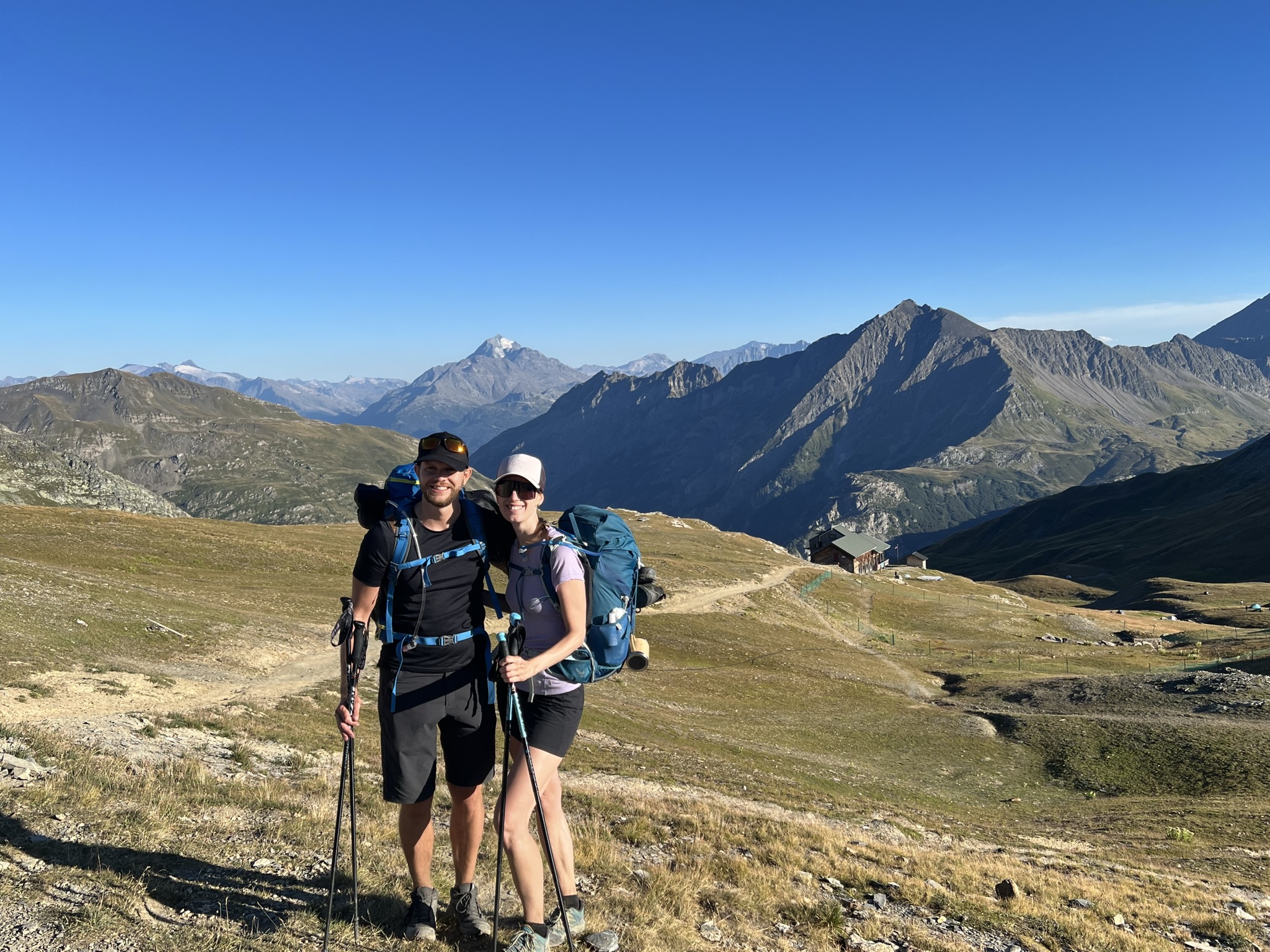
1. den Les Houches (FRA) – Refuge du col de la Croix du Bonhomme (FRA) – 30 km, 2385 m nahoru, 965 m dolů
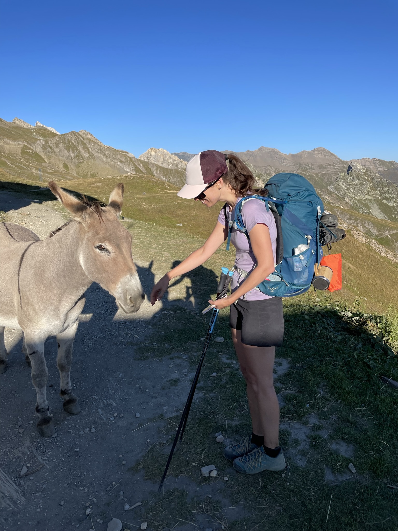
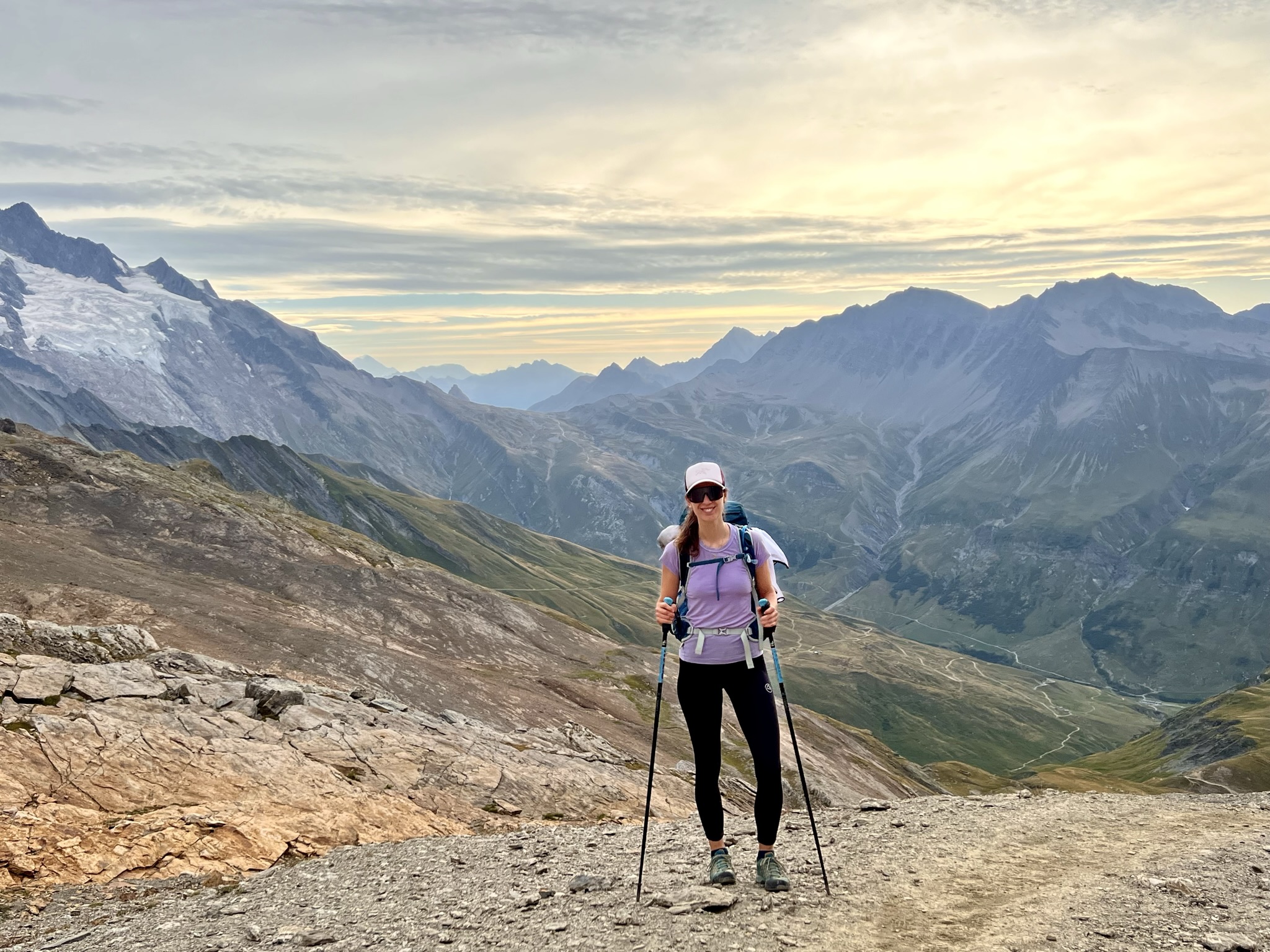
Začínáme! Pro mne první hike se stanem a spacákem na zádech. Batoh má i s jídlem 12 kilo, což považuju za úspěch. Z Les Houches vede cesta rovnou do kopce. Jde se po širších cestách a jedná se o docela příjemný začátek trasy. Už na tomto úseku si můžete zvolit a místo hlavní trasy pokračovat přes hory přes Mont Truc. Záleží kolik kilometrů denně máte v plánu a jak jste zvyklí chodit se zátěží. Musím uznat, že první den jsem po pár hodinách nevěděla, zda si dát batoh na břicho či na hlavu. Pak si to sedlo 🙂 Asi nejkrásnější úsek bylo stoupání do průsmyku Col du Bonhomme. Tam jsme také strávili první noc. Stan jsme postavili kousek dál za refugiem du col de la Croix du Bonhomme s krásným výhledem na okolní hory. Na večeři jsme šli do refugia a poté si vychutnávali krásný západ slunce. Je třeba počítat s tím, že stanujete ve výšce 2 450 m a v noci je zde chladněji.
1. day Les Houches (FRA) – Refuge du col de la Croix du Bonhomme (FRA) – 30 km, 2385 m up, 965 m down
Let’s get started! First hike for me with a tent and a sleeping bag on my back. The backpack has 12 kilos with food, which I consider a success. From Les Houches the trail leads straight uphill. It follows wider paths and it is quite a pleasant start ot the trail. Already on this part of the trail you can choose to continue over the mountains via Mont Truc instead of the main trail. It depends on how many kilometres a day you plan to hike and how are you used to walking with a loaded backpack. I have to admit that on the first day after few hours I didn’t know whether to put my backpack on my stomach or on my head. Then it settled 🙂 Probably the most beautiful part of the trail was the hike up to the pass Col du Bonhomme. There we spent our first night. We camped a little further from the Refugio du col de la Croix du Bonhomme with a beautiful view of the surrounding mountains. We went to Refugio for dinner and then enjoyed a beautiful sunset. Here you have to take into account that you are camping at 2,450 m and it is cooler at night.
2. den Refuge du col de la Croix du Bonhomme (FRA) – kemp Grande Jorasses (ITA) – 41 km, 2034 nahoru, 2871 dolů
Ráno jsme vstali, udělali si snídani a vyrazili. Vystoupali jsme kousek nahoru a otevřel se nám krásný výhled na trasu, která nás čekala až na hranice s Itálií. Začali jsme tedy sestupem dolů. Poté jsme vystoupali do průsmyku Col de la Seigne – hranice Francie a Itálie. Prošli jsme údolím a zelenými pastvinami a zastavili se na občerstvení v refugiu Elisabetta Soldini Montanaro hned pod ledovcem. Je zde opravdu krásný výhled na ledovec a údolí pod ním. Poté jsme pokračovali přes hory až do města Courmayer. Jelikož se v Itálii nesmí stanovat mimo kempy, rozhodli jsme se ubytovat v kempu Grande Jorasses. Z města můžete jet do kempu také autobusem. Kemp byl nově zrekonstruovaný a po příjemné sprše jsme si dali také italskou pizzu. Po 41 km v nohách nám jedna pizza nestačila a tak jsme trhli svůj osobní rekord a každý povečeřeli 2 pizzy 😀
2. day Refuge du col de la Croix du Bonhomme (FRA) – Camping Grande Jorasses (ITA) – 41 km, 2034 up, 2871 down
In the morning we got up, made breakfast and set off. We hiked up a bit and had a beautiful view of the trail that led us to the border with Italy. We started by going down the hill and then we hiked up to the Col de la Seigne – the border of France and Italy. We passed through the valley and green pastures and stopped for refreshments at the refugio Elisabetta Soldini Montanaro just below the glacier. There is a really beautiful view of the glacier and the valley below. We then continued over the mountains to the town of Courmayer. Since you are not allowed to camp outside campsites in Italy, we decided to stay at the Grande Jorasses campsite. You can also take a bus from the town to the campsite. The campsite was newly renovated and after a nice shower we also had Italian pizza. After 41 km in legs, one pizza was not enough so we broke our personal record and had 2 pizzas each 😀


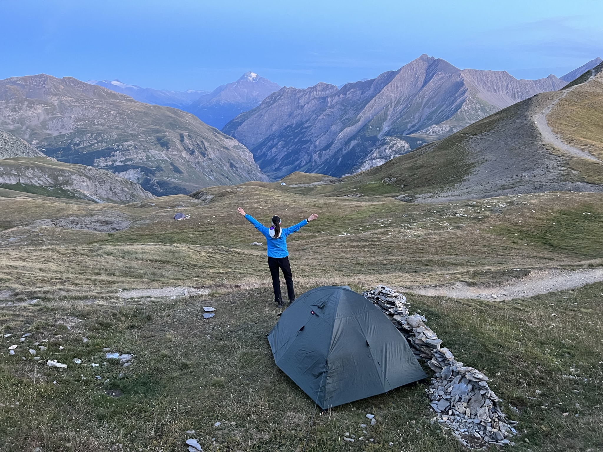
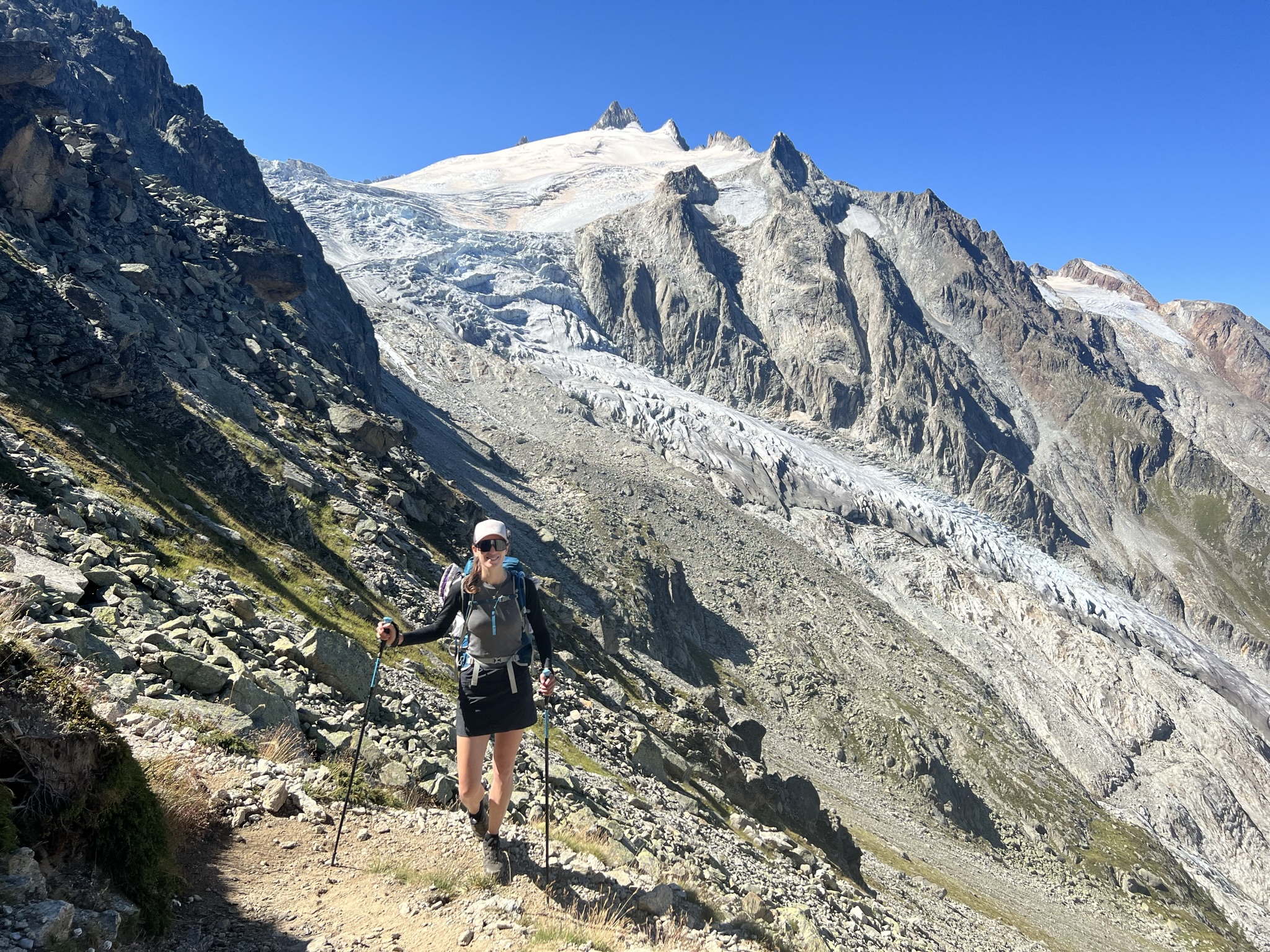
3. den kemp Grande Jorasses – Champex Lax campground (SUI) 41 km, 2116 m nahoru, 2232 m dolů
Tento úsek byl jeden z mých nejoblíbenějších na trase. Z kempu jsme tentokrát vyšli opravdu brzo, jelikož nás čekalo dalších 41 km. Vystoupali jsme do prudkého kopce s výhledem na osvícený Mont Blanc v zádech. Poté cesta vedla po úpatí nad údolím s neskutečným výhledem. Když jsme dorazili na konec údolí, doplnili jsme vodu v refugiu Elena těsně pod průsmykem Grand Col Ferret – hranice Itálie a Švýcarska a začali stoupat do průsmyku.
3. day Grande Jorasses campground – Champex Lax campground (SUI) 41 km, 2116 m up, 2232 m down
This part of the trail was one of my favourites. We left the campsite really as we had another 41 km to go. We hiked up a steep hill with a view of the illuminated Mont Blanc behind us. Then the trail led above the valley with incredible views. When we reached the end of the valley, we refilled water at the refugio Elena just below the Grand Col Ferret pass – the border of Italy and Switzerland – and began the hike uphill to the pass.


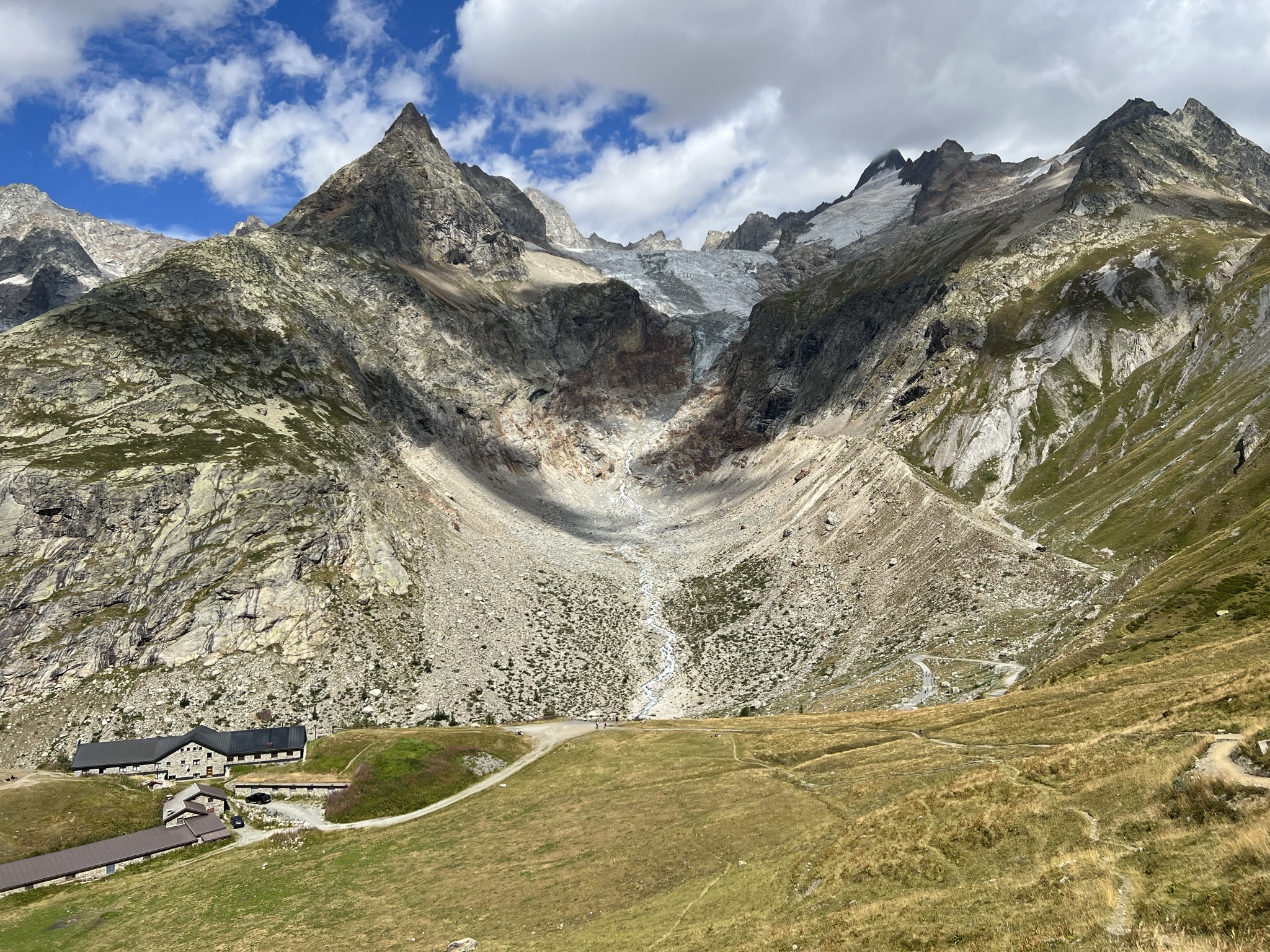
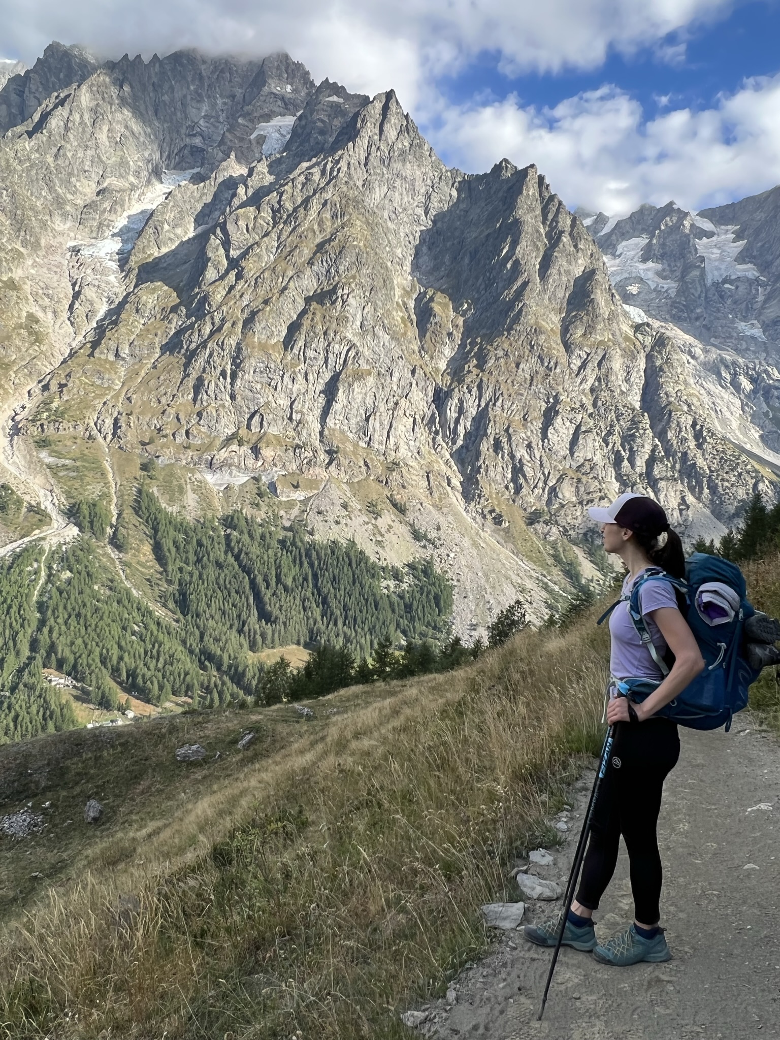
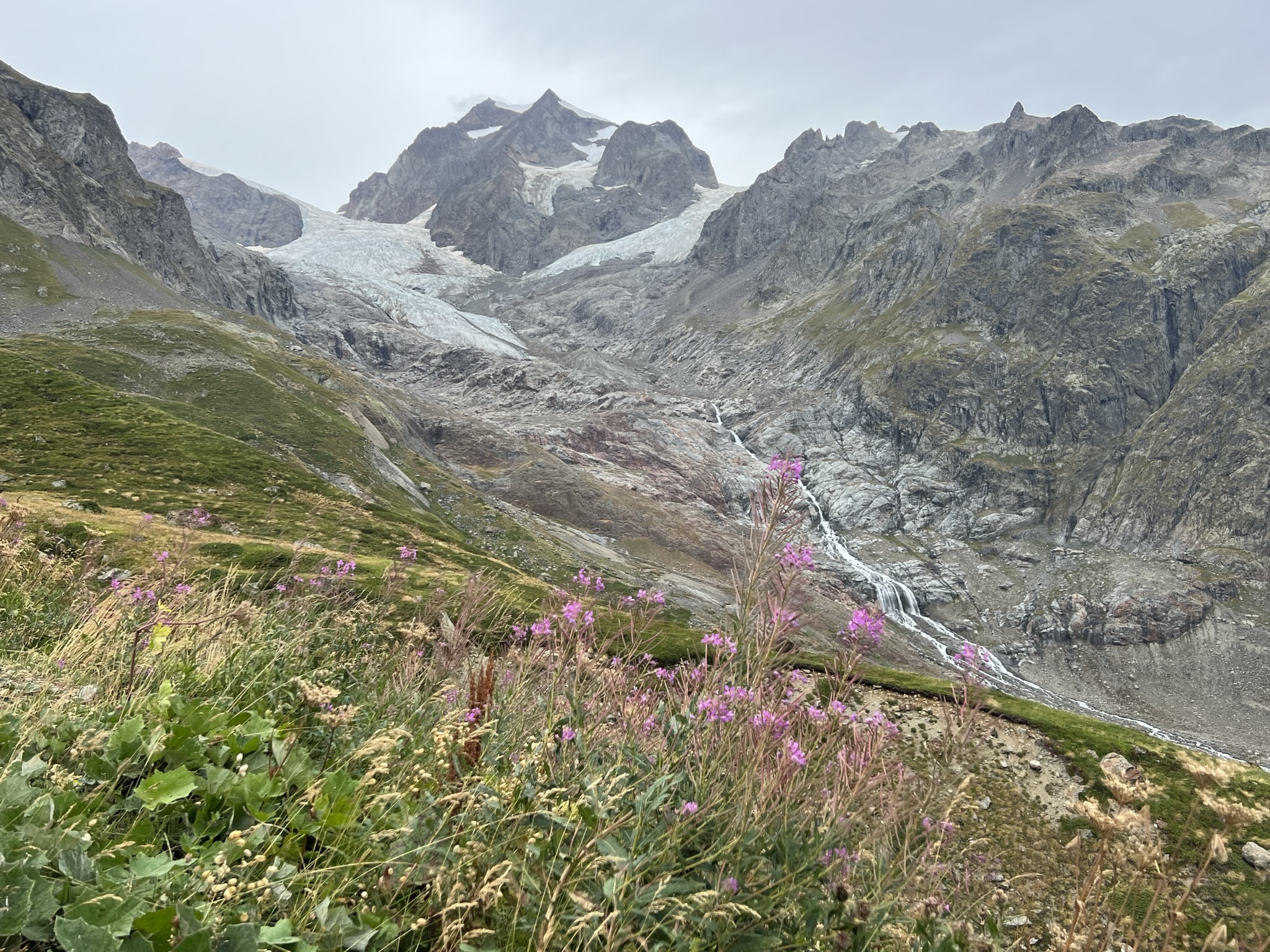
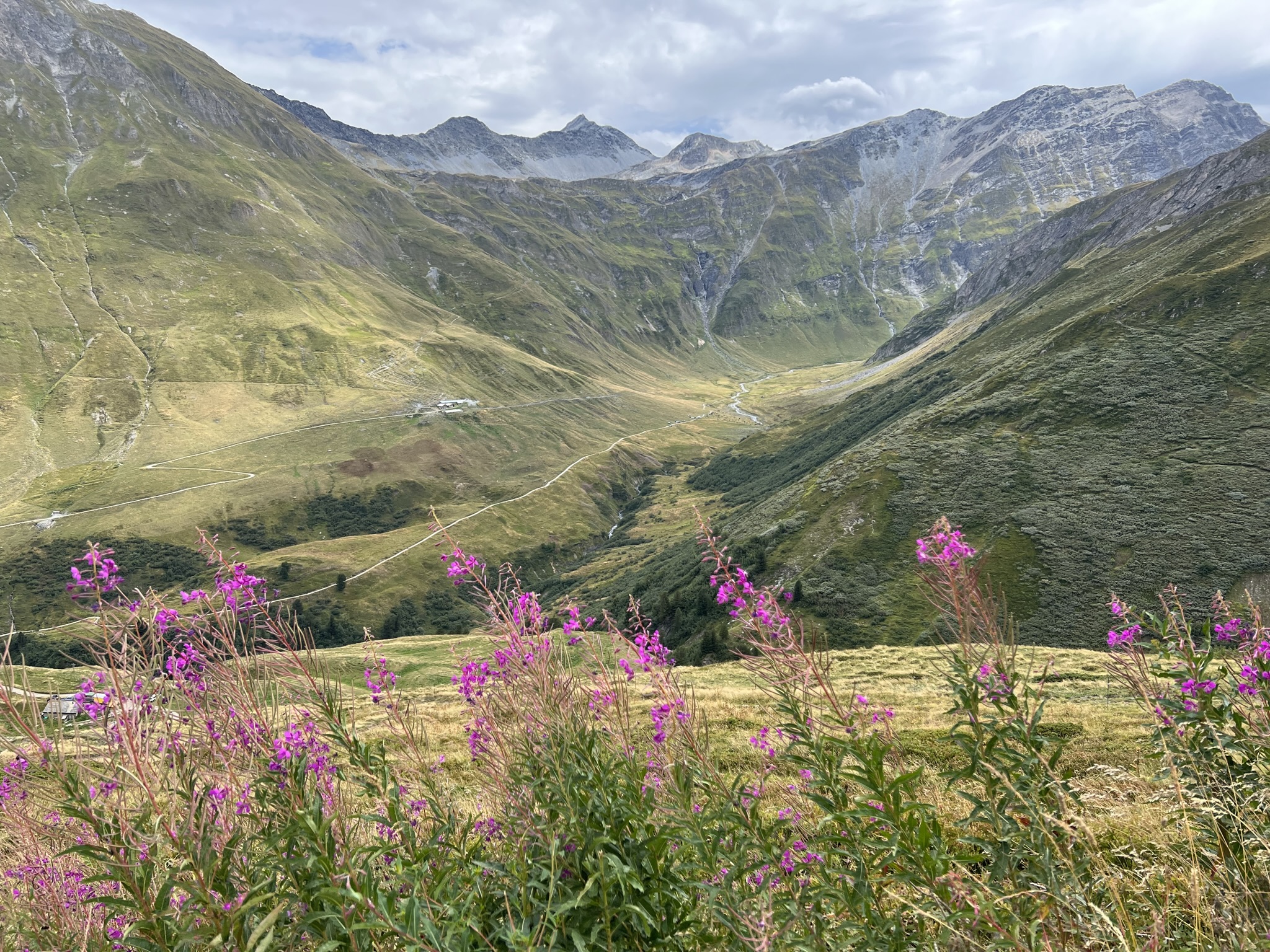
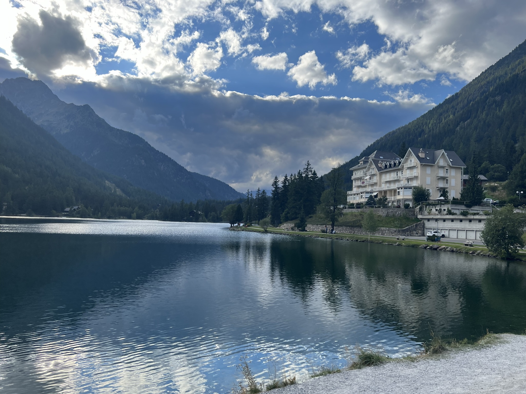
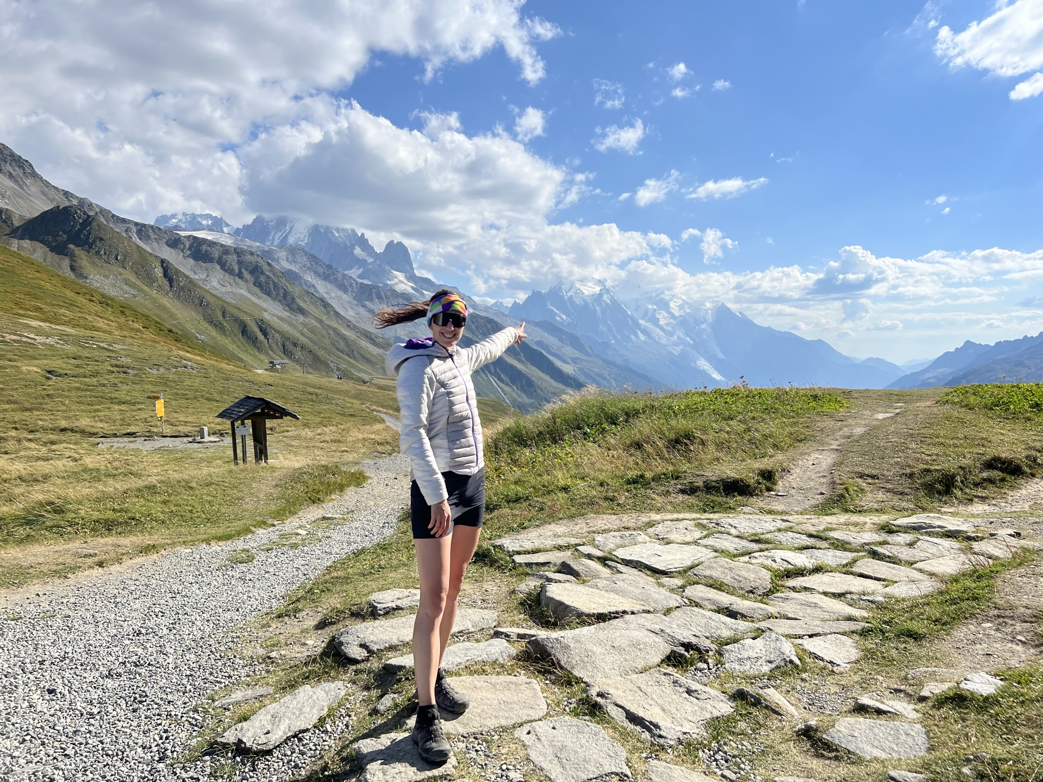
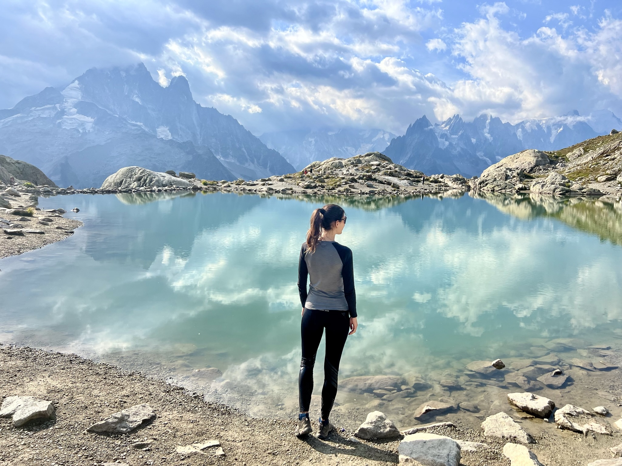
Zatímco italská strana poskytuje výhledy na skály a ledovce, švýcarská strana naskýtá výhled na krásné zvlněné zelené louky a pastviny. Na oběd jsme se zastavili v refugiu La Peule – nejlepší jídlo na trase – domácí sýry, vajíčka a neskutečný výhled (foto s růžovými květinami níže). Poté trasa vede dlouho z kopce a údolím přes malebné švýcarské vesničky. Dlouhý rovný úsek byl tentokrát mnohem únavnější než chůze do kopce a z kopce v horách. Stoupání nás čekalo ještě na konci úseku, kdy jsme vystoupali do městečka Champex Lax (foto č. 4 níže), kde jsme se ubytovali v miniaturním kempu. Po náročném dni jsme usnuli snad dřív, než jsme ulehli do spacáku.
While the Italian side offers views of cliffs and glaciers, the Swiss side offers views of beautiful rolling green meadows and pastures. We stopped for lunch at Refugio La Peule – the best meal on the trail – homemade cheeses, eggs and incredible views (photo with pink flowers below). Then the trail goes a long way downhill and through the valley through picturesque Swiss villages. The long flat part of the trail was much more tiring than hiking uphill and downhill in the mountains. Hiking uphill was still waiting for us at the end of today’s trail, when we hiked to the town of Champex Lax (photo no. 4 below) and where we stayed in a miniature campsite. After a busy day, we fell asleep perhaps before we got into our sleeping bags.
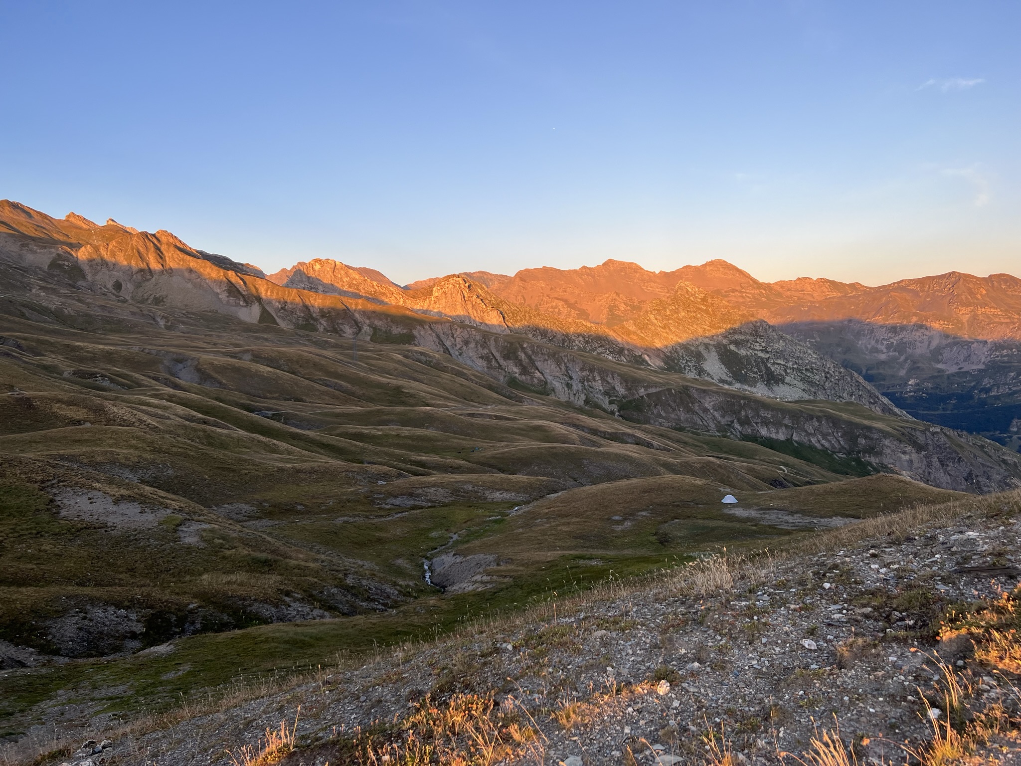
4. den kemp Champex Lax (SUI) – Tre-le Champ le Bas (FRA) – 26 km, 2067 m nahoru, 2153 m dolů
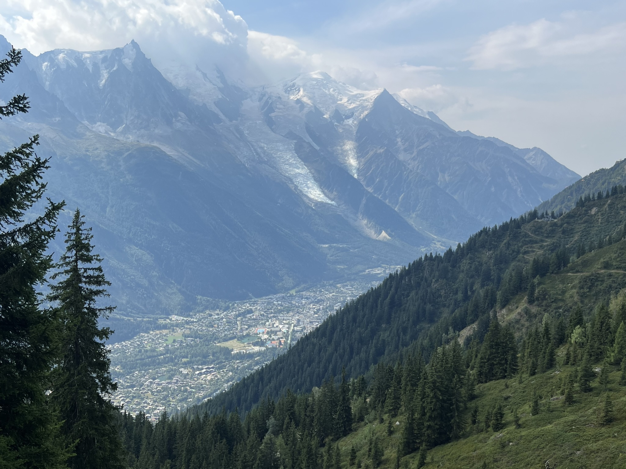
Další den sliboval překrásné počasí. Vstali jsme ještě za tmy a vyrazili se svítáním. Očekávali jsme, že dnes zakempujeme dříve a lehce vydechneme. Velký omyl, čekal nás nejtěžší úsek, což jsme vůbec nečekali. Na doporučení jsme se totiž rozhodli sejít z hlavní trasy a jít alternativní trasou kolem ledovce Trient. Dle mapy vzdálenostně téměř stejné, výškový profil o něco vyšší a časově o nějakou hodinku delší než hlavní trasa. Šlo se přes velmi prudký šotolinový terén a balvany, kde nebylo možné jít a použít hůlky a bylo třeba mít volné ruce a spíše lézt. Na vrchol jsme se škrábali opět velmi prudkou šotolinou tak, že jsme museli dávat velký pozor, abychom nesjeli dolů. A pak jsme konečně byli nahoře. Nádherný výhled na ledovec, nádherné počasí bez větru a mráčku. Asi nejkrásnější výhledy celé trasy. Chvíli jsme si tedy užívali zasloužený výhled a slunili se. Poté jsme se vydali na sestup dolů kolem koryta ledovce až do údolí. Cesta se zdála až nekonečná, protože jsme museli opět překonávat náročný terén. Na trase navíc nebyla ani voda, která nám již docházela. Dole u řeky naštěstí bylo malé bistro Challet du Glacier, kde se dalo občerstvit. Poté přišlo další velmi ostré a dlouhé stoupání až do průsmyku Col de Balme – hranice Švýcarska a Francie. Výhledy krásné, ale už nám docházely síly, čas a světlo.
4. day Champex Lax campground (SUI) – Tre-le Champ le Bas (FRA) – 26 km, 2067 m up, 2153 m down
The next day promised beautiful weather. We got up in the dark and set off at dawn. We were expecting to camp earlier today and get some time to rest. Big mistake, we had the hardest part ahead of us, which we didn’t expect at all. On recommendation we decided to deviate from the main route and take an alternative route around the Trient Glacier. According to the map, the distance was almost the same, the altitude profile was a bit higher and the hiking time was about an hour longer than the main route. We went through very steep gravel terrain and boulders, where it was impossible to walk and use poles and we had to have our hands free and rather climb. We hiked to the top again through very steep gravel so that we had to be very careful not to slip and fall down. And then finally we were at the top. Beautiful view of the glacier, beautiful weather with no wind and no clouds. Probably the most beautiful views of the whole trail. We enjoyed the well-deserved view and were sunbathing for a while. Then we started our descent down around the glacier to the valley. The trail down seemed almost endless as we had to traverse challenging terrain again. Moreover, there was no water on the trail, which we were already running out of. Fortunately, there was a small bistro down by the river, Challet du Glacier, where we could refresh ourselves. Then came another very sharp and long hike up to the Col de Balme pass – the border of Switzerland and France. The views were beautiful, but we were running out of energy, time and light.


Col de Balme byl asi nejkrásnější z průsmyků s výhledem na Mont Blanc přímo před námi. V refugiu jsme jen doplnili vodu a šli po hřebenu dále. Výhledy byly opravdu dechberoucí. Všechny odstíny zelené, růžový vřes, žluté luční kvítí a výhled na skály a ledovce. Chvíli jsme zvažovali jestli, zde nepostavíme stan, ale nakonec jsme se rozhodli dojít až dolů do údolí, kde si dáme v refugiu La Boerne pořádné jídlo. Je zde i menší místo, kde se dá postavit stan. Míst je však jen pár, takže se může stát, že bude plno a budete muset pokračovat dále. Ulehli jsme a nastavili budík na ráno tak, abychom vstali opět ještě za tmy, protože jsme potřebovali dojít poslední úsek co nejdříve odpoledne, než se zkazí počasí a přijdou bouřky.
Col de Balme was probably the most beautiful of the passes with a view of Mont Blanc right in front of us. At Refugio we just refilled our water and continued along the ridge. The views were truly breathtaking. All shades of green, pink heather, yellow meadow flowers and views of rocks and glaciers. We debated for a while whether we should camp uphere, but finally decided to walk all the way down to the valley where we would have a proper meal at the refugio La Boerne. There is a place to camp with only a few spots for a tent right next to the refugio, so when it gets crowded, you may have to continue on. We went to sleep and set the alarm for the morning so that we would get up again in the dark, as we needed to complete the last part of the trail as early in the afternoon as possible before the weather turned bad and the storms came.

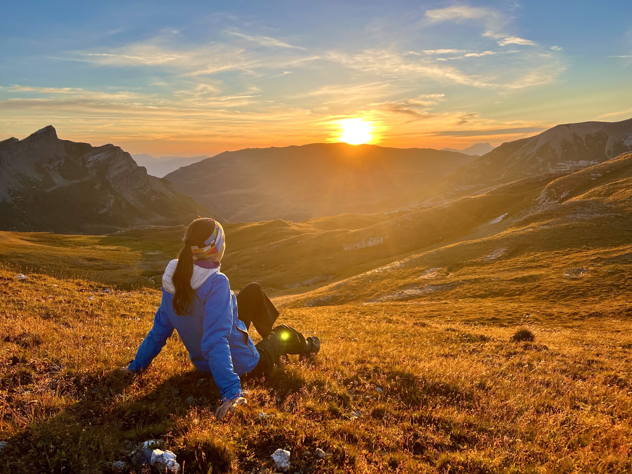
5. den Tre-le Champ le Bas (FRA) – Les Houches (FRA) 27 km, 1931 m nahoru, 2316 m dolů
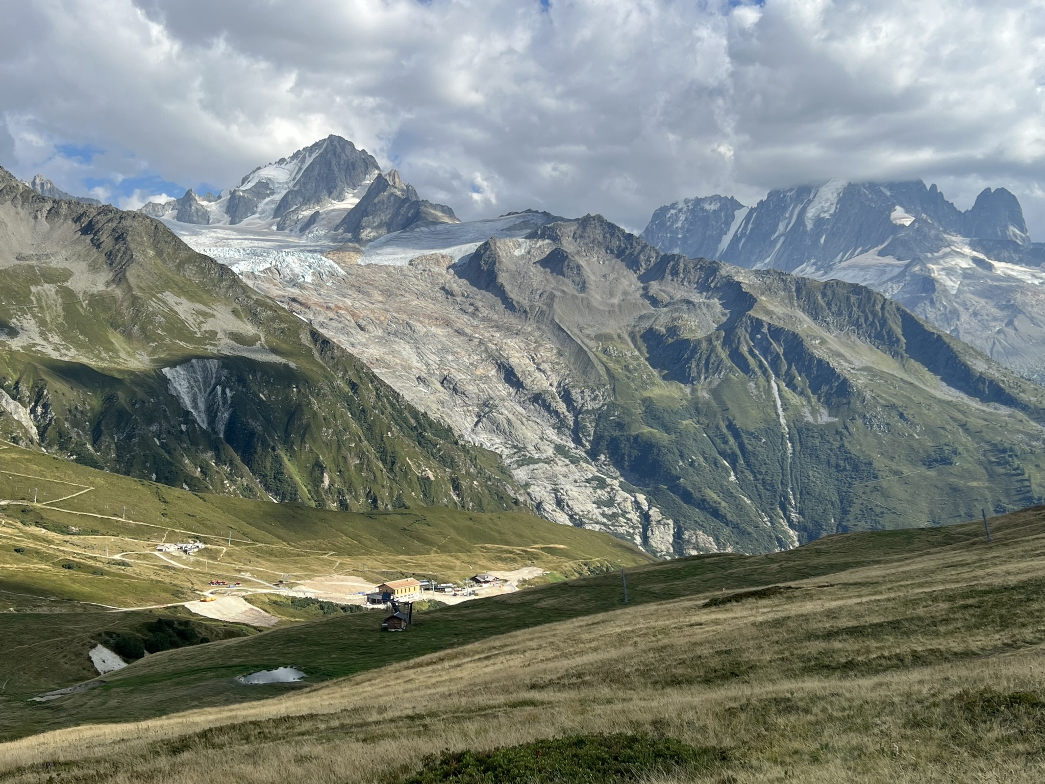
S hrozbou odpoledních bouřek jsme vyrazili na trasu brzo ráno. Trasa vedla hned do kopce přes les, vřesoviště až k jezeru Lac Blanc. Na trase jsme byli sami a nad lesem přímo u trasy se nám podařilo vidět i kozoroha. Pak jsme se po železných žebřících bez front posouvali svižným tempem výše. Dnes mě trasa opravdu bavila. U prvních jezer slunce vytvářelo přes mraky světelné kužely, ráno jako z pohádky. Poslední den na trase, 150 km a 10 tis převýšení v nohách a můj nynější manžel ještě zvládnul pokleknout a požádat mě o ruku. Poté, co jsem zalapala po dechu překvapením, jsem samozřejmě řekla “ANO.” Zbytek cesty jsem se musela hlídat, abych nezakopla, protože můj pohled místo pod nohy sklouzával na můj prsteníček. Stále jsem tomu nemohla uvěřit 🙂 Tour de Mont Blanc a hlavně tento úsek tak zůstane v mém srdci už napořád.
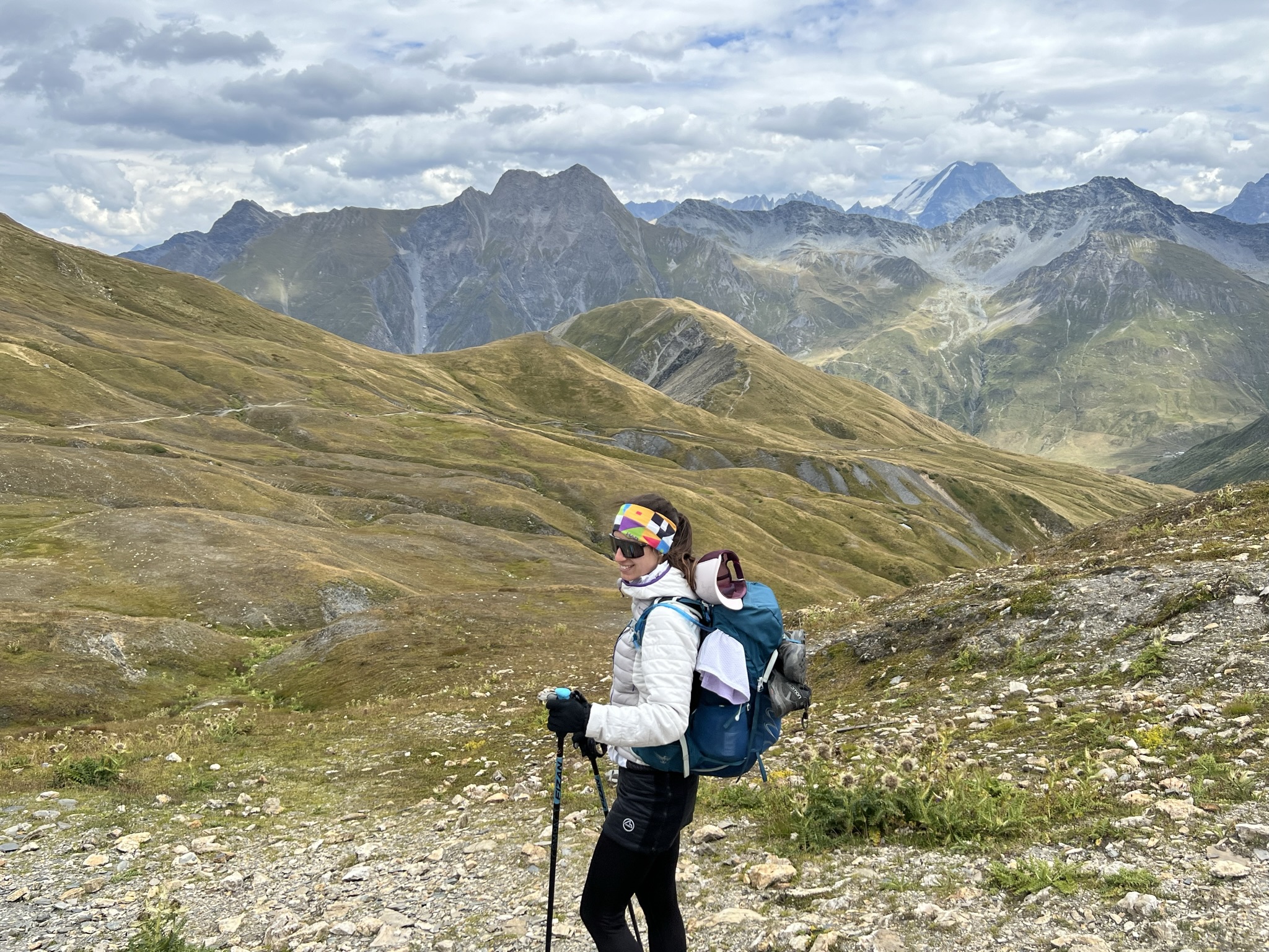
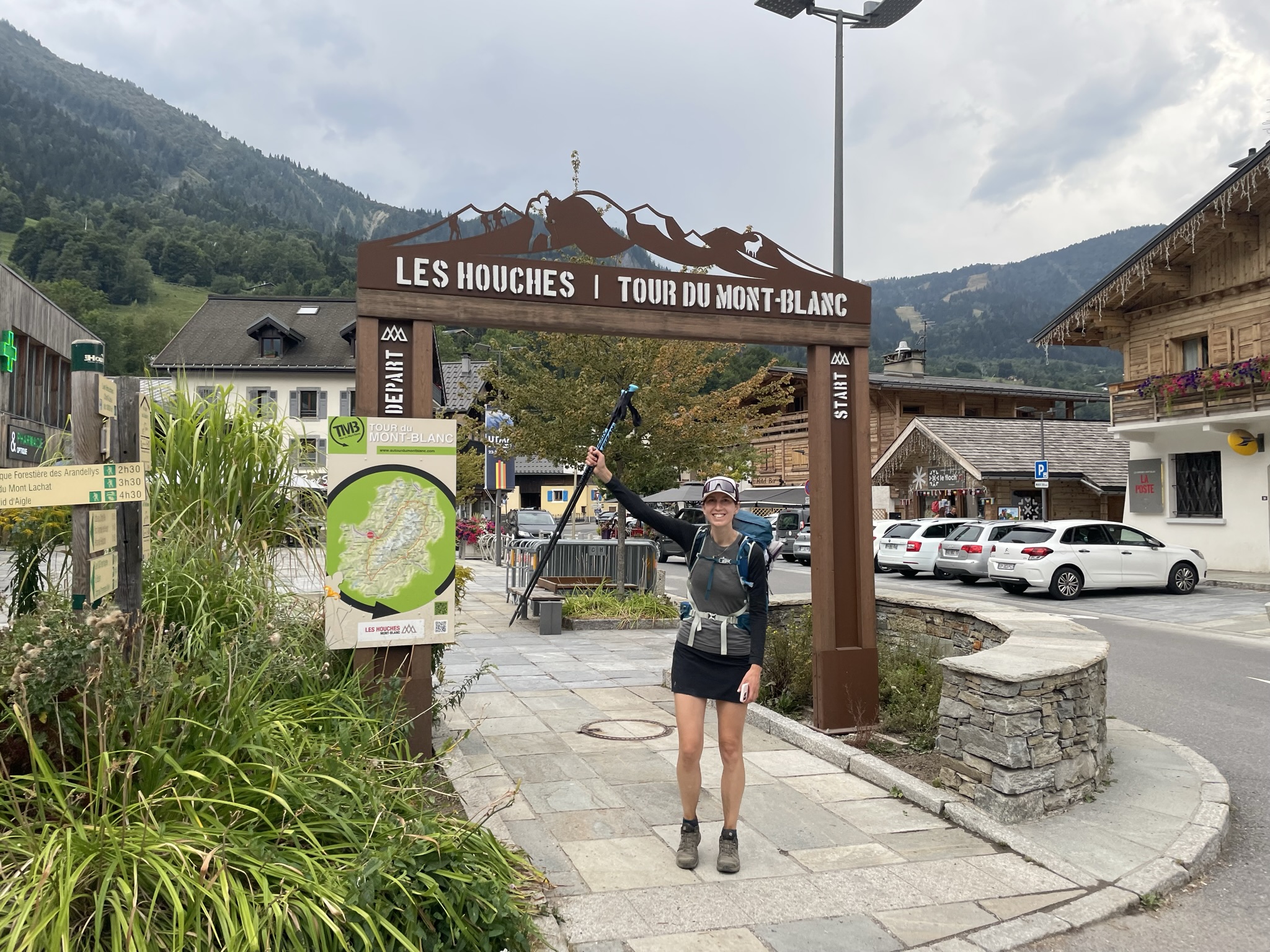
Lac Blanc je krásné jezero. Stojí za to vyjít i kousek nad něj, výhled je zase trošku jiný. Potom už trasa pokračuje po hřebenu s výhledem na ikonický Mont Blanc, který vyčnívá přímo nad trasou (fotka č. 3 níže). Když jsme se podívali z hřebene dolů a viděli pod sebou město Chamonix, měli jsme pocit, že přistáváme v letadle. Na poslední den opravdu nemohl vyjít krásnější úsek. Poslední hodinu už jsme slyšeli hřmění a tak jsme téměř v poklusu došli do městečka Les Houches, kde jsme se vyfotili u startovní a zároveň cílové brány trasy a pokračovali další kilometr a půl do auta. Jen co jsme do něj sedli, začalo pršet. Zamířili jsme tedy do hotelu a dali si zaslouženou sprchu. A určitě znáte ten pocit, kdy si připadáte jak úplně nový a naprosto spokojený člověk 🙂
5. day Tre-le Champ le Bas (FRA) – Les Houches (FRA) 27 km, 1931 m up, 2316 m down
With the threat of afternoon thunderstorms, we hit the trail early in the morning. The trail went straight uphill through the forest and moorland to Lac Blanc. We were alone on the trail and were lucky to see a ibex right next to the trail. Then we climbed up the iron ladders at a brisk pace without queues. I really enjoyed the trail today. At the first lakes the sun was creating cones of light through the clouds, a morning like from a fairy tale. Last day on the trail, 150 km and 10k of elevation gain in our legs and my now husband still managed to kneel down and ask me to marry him. After gasping in surprise, I of course said “YES.” I had to watch myself the rest of the day to make sure I didn’t trip because my look was sliding to my ring finger instead of under my feet. I still couldn’t believe it 🙂 The Tour de Mont Blanc and especially this part will remain in my heart forever.
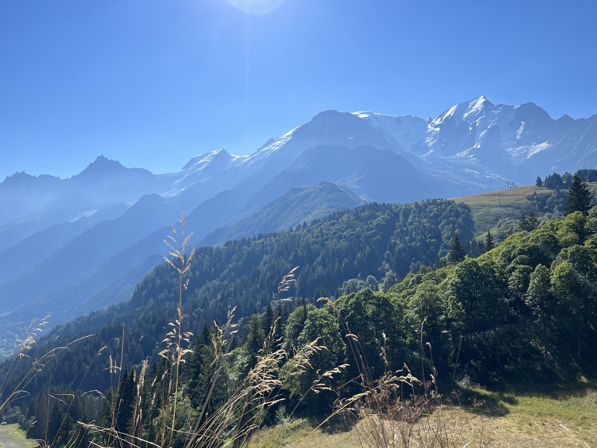
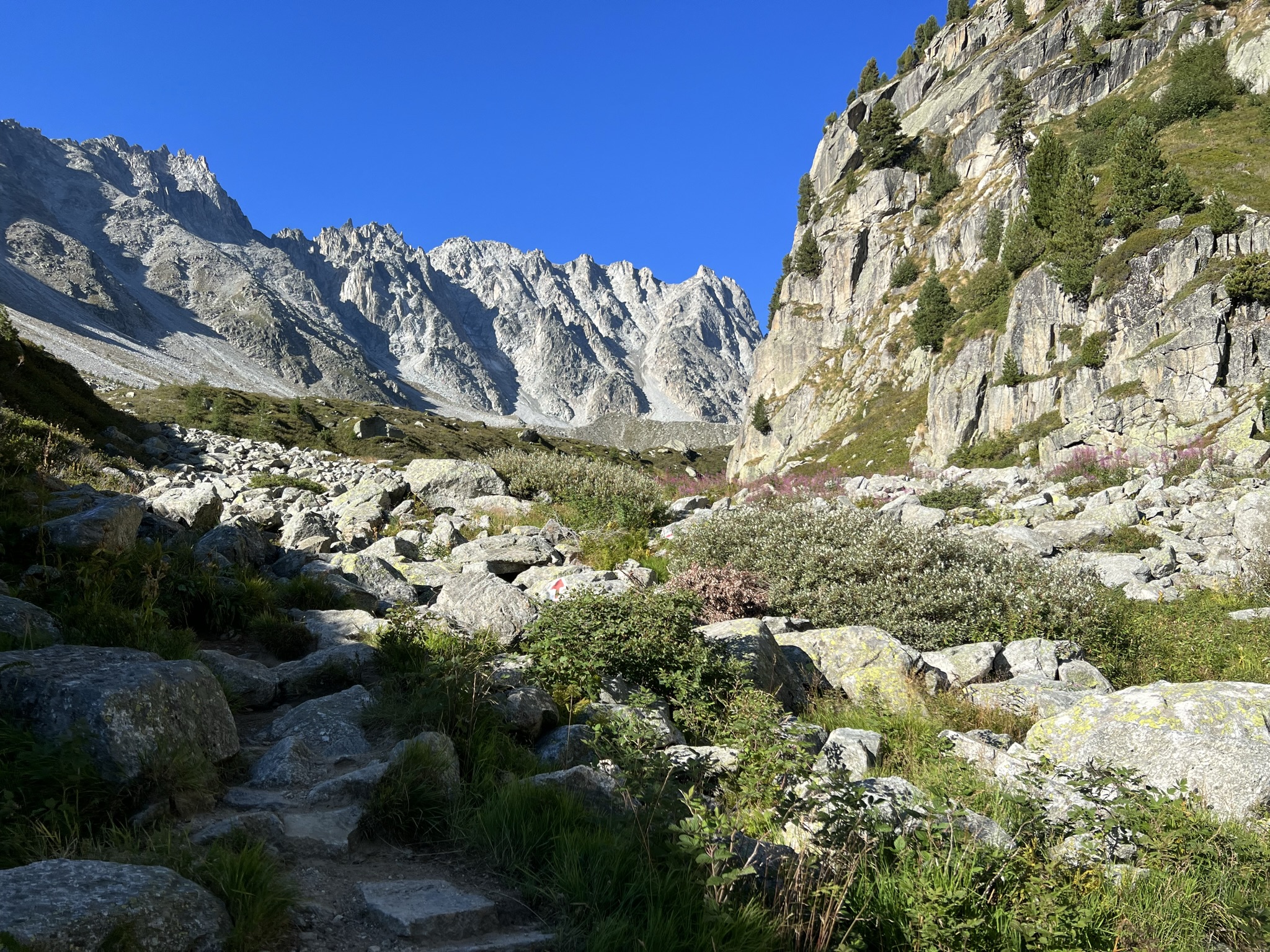
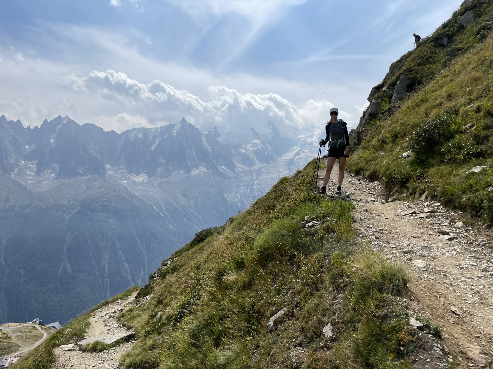
Lac Blanc is a beautiful lake. It’s worth going up above the lake, the view is a little bit different. After that, the route continues along the ridge with views of the iconic Mont Blanc looming directly above the route (photo 3 below). Looking down from the ridge and seeing the town of Chamonix below us, it felt like we were landing on a plane. We couldn’t choose a more beautiful part of the trail to finish the TMB. For the last hour we could hear thunder and so we almost run to the town of Les Houches. We took a photo at the start/finish gate of the trail and continued another kilometer and a half to the car. Just as we got in, it started to rain. So we headed to the hotel and took a well-deserved shower. And I’m sure you know that feeling when you feel like a brand new and completely satisfied person 🙂


Tour de Mont Blanc se nám opravdu moc líbila. Je to nádherná trasa od začátku až do konce. Navíc se jedná o okruh a není třeba řešit dopravu zpět k autu. Trasa je skvěle zásobována pitnou vodou, jídlem i možnostmi ubytování a není třeba ji plánovat dlouho předem. Stačí si jen pohlídat dobré počasí a vyrazit 🙂
We really enjoyed the Tour de Mont Blanc. It is a beautiful route from the beginning to the end. Moreover, it is a circuit, so there is no need to deal with transport back to your car. The route is well supplied with drinking water, food and accommodation options. There is no need to plan the trail long in advance. Just make sure the weather is good and go 🙂